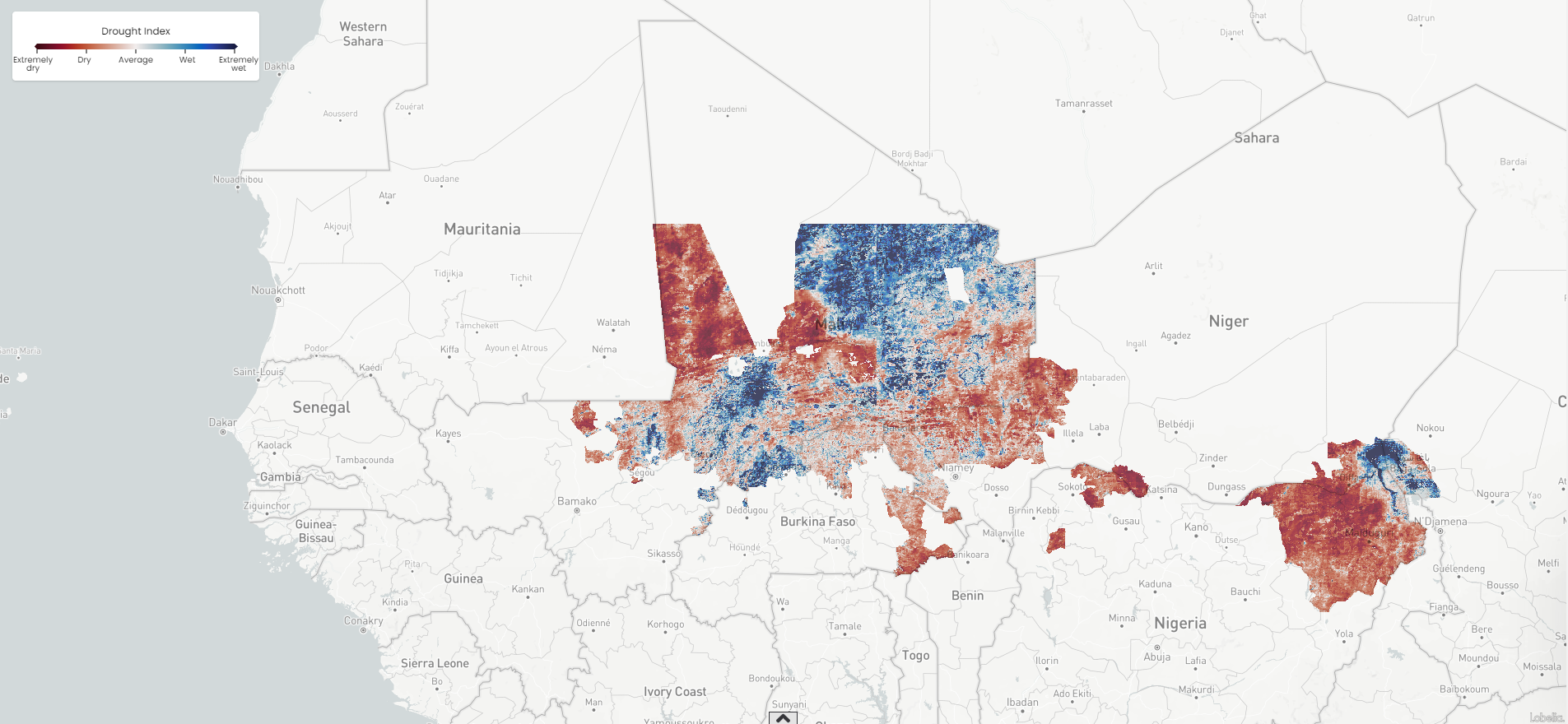
 Earth surface drought index. IMAGE: IsardSAT
SnapEarth is an EU H2020-funded project that aims to facilitate access to Earth Observation data from the general public thanks to EO data labelling and indexation innovations and access. It seeks to bring out new values through large-scale Earth Observation data services and to anticipate future priorities by leveraging artificial intelligence and cloud computing technologies and tools.
The project has developed 2 services (EarthSelf and EarthSearch) and 4 business pilots.
EarthSelf is a technological component that enables any business or user to take advantage of highly scalable cloud environments for analysis, visualisation and production of Earth observation value-added services. EarthSearch is a portal for natural language queries on images, allowing users to express questions in natural language on images and get either a text response or an imagery response.
The EarthFoodSecurity Pilot, led by isardSAT, is built on top of in-situ information of soil moisture conditions, and runs with Copernicus Climate Change Service (C3S) projections of climate change. This pilot aims at providing the users with a set of value-added services including historical and current data in the area of interest, and a forecast report to predict future changes in the area of interest.