 SMART methodology will produce Root Zone Soil Moisture (RZSM) at a 100 m scale © isardSAT
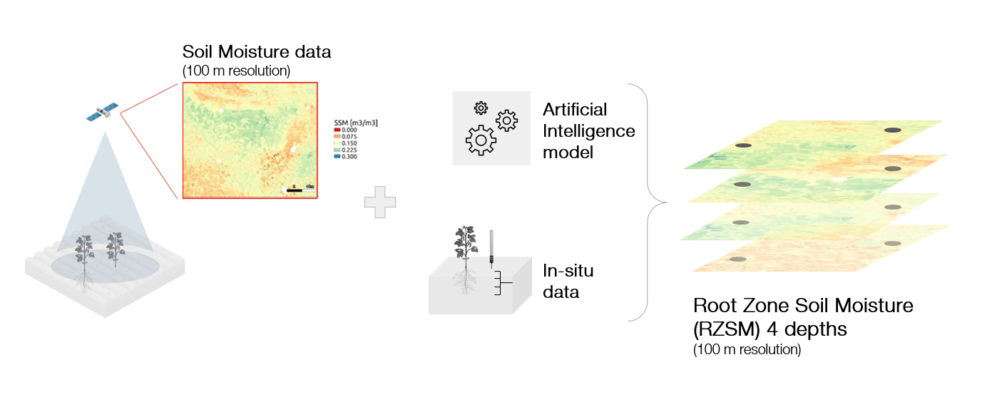
The SMART project will improve drought monitoring capabilities through remote sensing soil moisture products at a high spatial and temporal resolution. By combining data from different sensors (Sentinel-1, Sentinel-2, Sentinel-3, Landsat 8 and 9, MODIS, SMOS and SMAP), SMART will develop a pioneer methodology to retrieve surface soil moisture data at a scale of 100 m every 2-3 days, with a precision greater than 10%. Furthermore, this methodology will not need any calibration and is transferable to any other part of the globe where this data is available.”
The obtained data will be combined with in situ measurements and an artificial intelligence model that will allow for the calculation of Root Zone Soil Moisture (RZSM) at the same scale and precision. The resulting products will enable to estimate yield at a field scale, and ultimately evaluate wildfire dynamics.
isardSAT will lead the algorithms design, development and implementation, and will develop a system to monitor drought from the soil moisture indexes obtained.
Go to project site