The CryoSat Plus for Ocean (CP4O) project was born as an opportunity to take advantage of a new altimetry data type with a higher resolution and a new interferometric mode (SARIn).
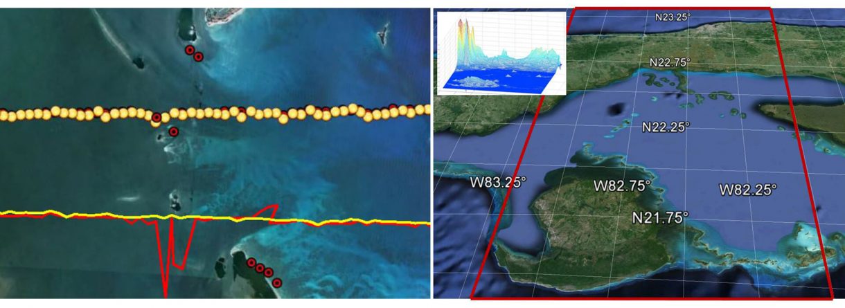
There is a special interest in knowing more about the ocean coast behaviour due to the human-coast relation. In coastal areas, land signal interferences cause data degradation and often make impossible scientific oceanographic applications.
Considering that the CryoSat mission measures the thickness of ice floating in the oceans and polar ice covers, but the potential of the SIRAL data applications is greater, the CP4O project covers the need of oceanographic studies with CryoSat measurements.
isardSAT joined the CryoSat Plus for Ocean consortium, a top-level European experts team, as been responsible for the study of coastal areas using SARIn data. A specific algorithm was developed for avoiding the undesired interferences. One year of CryoSat SARIn data around Cuba were been processed applying the designed algorithms, achieving an overall improvement of sea surface height (SSH) stability close to 50%.
Go to site
References:
García, Pablo & Martin-Puig, Cristina & Roca, Mònica. (2018). SARin mode, and a Window Delay approach, for Coastal Altimetry. Advances in Space Research. 62. 10.1016/j.asr.2018.03.015.